Very nice pictures....
You can get smart by just looking at some of these pictures.. 
Some days back, I viewed a TV documentary about a historic desert region at Jordanian / Israeli border. The region looked very similar to this area of Pakistan.
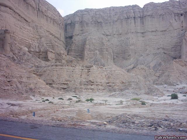
What attracted my attention is this picture in particular. The horizontal lines that you can see, in the mountain, are actually a very good "topographical recordings" of what has happened in the Climate of the Earth thru thousands of years.
Pakistan has alot of this type of data, hidden in its mountain, but too bad few people can intrepret what this data tells us. In the documentary they mentioned about the Horizontal lines, and how each line show a particular season, forexample the temperature variation, the climatic changes, the Earthquakes, heavy floods, all impact the surface of the earth in a unique way, and if there is discrepency in the formation of these horizontal lines, it depicts a severe event that occured in the past.
For the most part, you can see the lines flowing smoothly, except certain areas, that have abrupt shift in consistency of the horizontal lines, and these are not the nodes, and crevices, in the outer surface, those are obviously more recent.
Anyway, here is the picture, I am referring to.
May be I should have another Nick "Analytical Mind"...
