Assalam u Alaikum,
This weekend we planned a hiking trip to Ganga Choti in Bagh AJK.
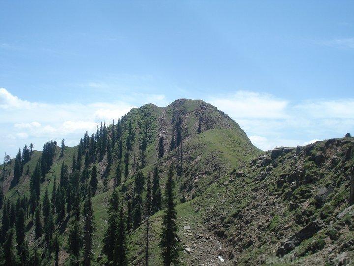
Alhamdulillah we completed our task of reaching the highest point of Ganga Choti and reached back Islamabad safely on 30th May. The hike was very enjoyable. The scenes from the top were exceptional. I recommend this hike to everyone who has a love for nature.
Day1: 29 MAY 2011
Started from Islamabad at about 12 noon. Had to delay our initial plan of leaving at 7AM due to some office related issues. Our route was
Islamabad - Nilore - Lehtrar - Kotli Sattian - Malot Sattian - Taeen Dhalkot Bridge - Arja - Bagh.
Islamabad-Dhalkot Bridge:
The distance is roughly 100 KM. We covered it in about 3-3.5 hours which included a couple of stops as well. The road condition was quite good or let's say it was not too bad. The weather after crossing Lehtrar was quite pleasant till the descent towards the Dhalkot Bridge.
Dhalkot Bridge-Arja:
Total distance of this patch was 35 km.From Dhalkot Bridge on river Jehlum the road condition was very bad. We had our car hit from beneath quite a few times. These 35 KM were covered in roughly 1-1.5 hours.
Arja-Bagh:
Total distance is roughly 20KM. Road is newly laid black top. Total time was roughly 15 min. We reached Bagh at about 5PM.
Bagh-Kotla:
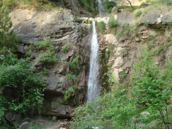
While searching for some places worth seeing around Bagh I found a place called Kotla which was supposed to be very green with multi-step waterfall and a beautiful chashma. The only problem was that there were couple of videos on youtube about the waterfalls without describing its whereabouts. So I searched google earth and found a picture of the Chashma. I traced the path to that point and fed it to my GPS.
I followed the route and the waterfall and chashma were exactly at the same spot as what some guy had posted a picture in google earth. It was a very very beautiful road going through the jungle and fruit trees. The road was in quite good condition for most of the time. There were couple of spots where the slope was quite steep and we had to get out of the vehicle. Total distance is roughly 7.5 KM on this road.
Bagh-Sudhan Gali:
Total distance is roughly 25KM and time taken was about 1 hour. The road is quite good for most of the time except where there is a Nallah crossing.
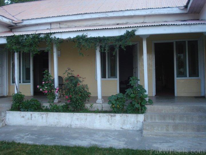
We reached Sudhan Gali at about 830 PM. We had already booked the AJK Tourism rest house and stayed the night there.
Day2: 30 May 2011
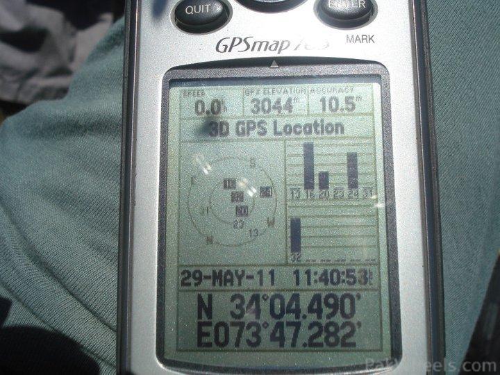
Started the day early. Took our breakfast at about 7AM and started the hike at about 0830AM. Reached the top in about 3 hours and 15 min. Spent some time up and then descended. Total time to descend was roughly 1 hour and 40 min. Reached rest house at about 2PM.
Sudhan Gali-Chikar:
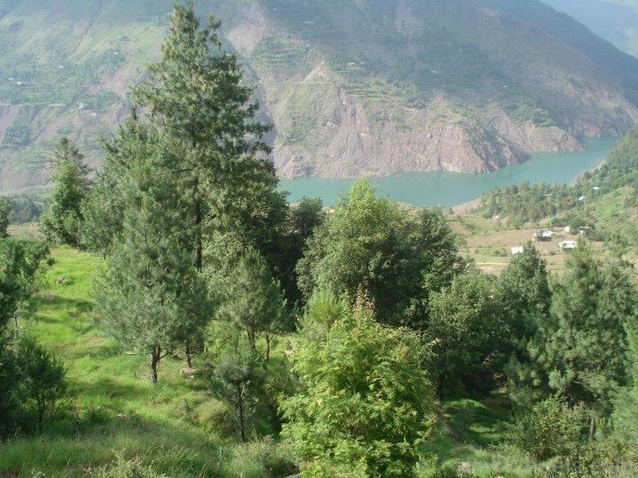
For our return journey we chose a different route. We returned via Chikar-Muzaffarabad route. The road from Sudhan Gali to Chikar was quite good for the first 10-15 KM. The last 5-6 KM were in really bad shape. Total time taken was 1 hour 15 min. which included a 10 min. break near the Zalzaal Lake.
Chikar-Hattian Bala-Muzaffarabad:
The road from Chikar to Hattian Bala was all descend. We reached Hattian Bala in roughly 40 min. From Hattian Bala to Muzaffarabad the road was almost in perfect shape (with the exception of a few KM's) It took us a total of 1 hr. 15 min. to reach Muzaffarabad from Chikaar.
Muzaffarabad - Kohala -Murree - Islamabad:
Last year the road from Muzaffarabad to Kohala was absolutely amazing. This time some patches of it were washed away by floods. But the work was in full flow. It took us almost 3 hours to reach Islamabad from Muzaffarabad.