By Hinesh Jethwani
Mumbai, October 11, 2004
A peculiar problem that I faced during my undergrad days when I designed my first enterprise logistics solution (an overzealous engineering college project), was the lack of accurate information about my country’s civil infrastructure topology -- more simply called ‘maps’ in the more colloquial tourist lingo.
Even with numerous Google searches and repeated requests to civic information departments, these tackily designed ‘maps’ had me all confused; I couldn’t even recognize the names of streets that I thought I knew like the back of my hand. The reason? You see, in India streets are very dynamic -- in both nomenclature and size. So the simply and aptly named Ballard Road can turn into ‘Shoorjee Vallabhdas Marg’ in a jiffy.
Maybe the situation has changed since then. But do you think that the Indian driver is ready to navigate his way through this concrete jungle without help forever?Technology, as always, presents a way out, but not without a million complications. With a total of 62,846 cars added to Indian streets in a single month this year (August), GPS would definitely be a multi-million dollar spinner for solution providers.
And its benefits to the Indian enterprise are simply too great to be ignored by our nation’s topology bureau (Not to sure whether it even exists). Consider the Rs 225 crore Safexpress Pvt Ltd., a third-party logistics provider that has become the first company in the Indian logistics industry to use GPS.
BEST is another transport services provider waiting to hop on the GPS bandwagon. Even Bharti has launched its very own GSM-GPS based Fleet Tracking Solution.
The $50 billion logistics market in India is bogged down by the usual constraints of a developing economy, namely inadequate infrastructure, complex tax structure and government apathy.
Echoing the concern is Victor Vasanth, manager, product development, MOL Logistics. “We hear the GPS buzzword for tracking vehicles and consignments, but ironically, roads in India are still not mapped for the purpose, barring those in major urban areas,” he says.
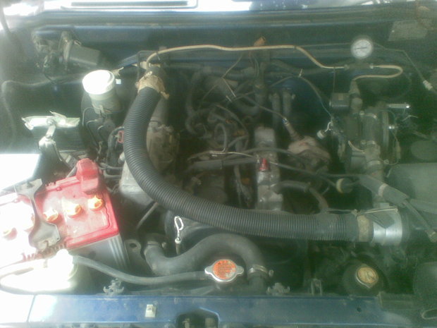
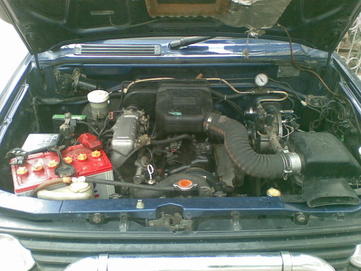
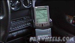
An early player in the passenger vehicle market is GPS India. The vendor has announced today the launch of its GPSMAP 276C, a GPS based automobile navigation device, tailor made for the Indian market.
The portable device works both over land and high seas, enabling the user to reach his destination, even in places where there are no visible landmarks -- such as over deserts or mountains, claims the manufacturer. Internationally such devices are used by transport services (land or sea), trucking companies, as well as individuals, especially in interstate traveling and adventure sports. But then again, they don’t suffer from the nomenclature phobia that we do.
The GPSMAP 276C is a chart plotter and automobile navigator with a 256-color TFT display. The solution guides the traveler in real time by displaying positions on a scale map and mapping his progress along the route. The device can also be used in city surroundings (buses, taxis, even private vehicles) and is especially useful for tourists and people visiting unfamiliar places, asserts GPS India.
According to the vendor, the solution is extremely user friendly and does not require any training — all the user has to do is to select his destination and the extremely crucial ‘map’ on the screen will guide him to his destination.
“The GPS technology is rapidly changing how people find their way around. The GPSMAP 276C will enhance the quality of life in cities and improve intra-city and inter-city transit, apart from opening up huge possibilities in logistics, security and adventure sports,” said Sumit Sabharwal, head - North India, GPS India.
“Tourists to India, for example stand to gain hugely if vehicles are fitted with GPSMAP 276C since they can be auto-directed to destinations of interest, restaurants, hotels even emergency services or embassies, without harassment or delays”, he added.
What remains to be seen however, is how a 6-inch display screen squeezes in street names that run into more characters than any GPS manufacturer ever imagined. And may be this is one system that needs to be hooked up to the local citizen information department, so that the systems display only the ‘most recent’ street name after every passing election.
Source: CXO Today