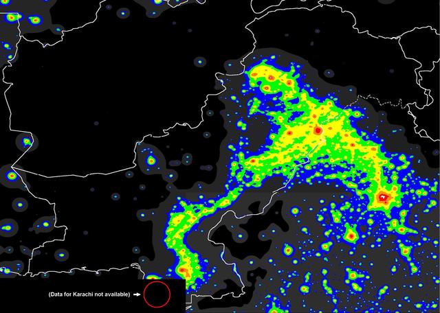
You can use the light-pollution map of Pakistan to locate potential destinations:
Link to full-resolution map.
Although it is not annotated, you can still identify/locate places because cities fall under the red/white (most light polluted) zones. You can also use the map as an overlay in Google Earth - link to the procedure. Finally, here's the legend to the color codes used in the map.
A green zone will have a much more starry sky than the one in cities. If you can head out to a blue zone, the sky will be impressive beyond words. Under a gray or a black zone, it is stupendous, although distant (artificial) light domes might be visible from the gray zone.


