In Dec 2006 i went for a Pakistan Tour from Karachi to Peshawar by road.
In that trip i visited many cities n places.
Took thousands of pics. so its not possible to post all pics covering many places just in one Topic. thats why i have divided that trip in different sections n will post each section independently to show u guys every possible detail of the visited places.
Each section contains many pics. i hope u guys will enjoy.
Now these r the pics of Tarbela Dam Project n, Ghazi-Barotha Barrage n Sirikot.
(all pics r reduced in size & quality)
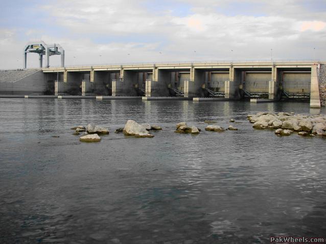
Tarbela Dam
Tarbela one of the largest earth-filled dams in the world and the largest dam in Pakistan is designed to store the waters of the Indus at a point where the river leaves the Himalayan foothills to enter the Potohar Plateau. Construction was started in 1968. Scheduled for completion in 1975, it was actually completed in 1974.
The earth-and-rock fill dam is 485 feet high. The crest elevation is 1,565 feet, and it is 9,000 feet in length. It has two irrigation outlets and two outlets for power generation. Each tunnel is 45 feet in diameter and 2,400 feet long.
The dam has two spillways, the service spillway and an auxilliary spillway, both located on the left side. The main spillway has 7 gates, each 50 feet wide and 50 feet high. The discharge capacity is 650,000 cusecs. Its power generating capacity is 1,400 megawatts at present and will eventually be increased to 4,000 megawatts.
GHAZI_BAROTHA Hydropower Project
The Ghazi-Barotha Hydropower Project consists of three main components:
A barrage at one end of the Indus River.
A power complex downstream which generate power.
A 52km concrete-lined power channel with a width of about 58.4 meters.
The GHAZI_BAROTHA hydropower project is a major run-of-the river environmentally sustainable power poject, designed to meet the acute shortage of peak power demand in our country. The project is based on the utilization of the head available in the INDUS RIVER between TARBELA DAM near GHAZI confluence with the HARO RIVER and the INDUS river near BAROTHA ( Attock). In this reach the INDUS RIVER drops by about 76m in a distance of 63km
The barrage located about 7km downstream of TARBELA DAM which regulate the daily disharges from Tarbela and divert the water into the power channel.
SIRIKOT
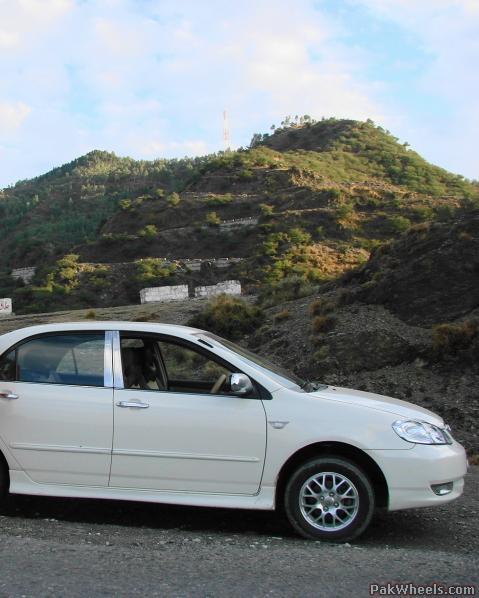
Sirikot is a village in tehsil Ghazi, district Haripur.NWFP. Sirikot lies between District Haripur n Tehsil Ghazi. it is a very popular village of Haripur District. it is situated on top of the hill which is known as mountain " gandghar". The surrounding area of Sirikot is mostly hilly. it is climatically very pleasant.
Gandghar is a series of mountains East of the Indus River.
The city of Haripur is situated in front of these mountains towards East and on West the glorious Indus River flows. In south it is touching Tarbela Dam and in North it touchs Hasanabdal.