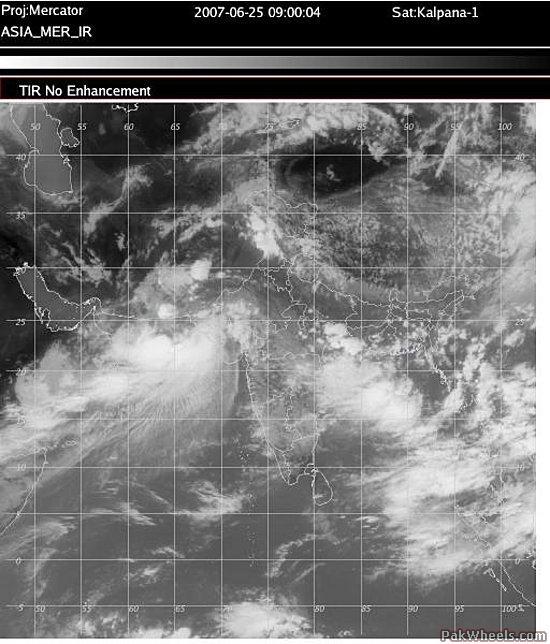
--Tropical Cyclone 03B has remade itself south of Karachi, Pakistan. The JTWC advises that highest sustained winds are near that of a minimal tropical storm (35 knots, or 65 kmh). The forecasters at JTWC make mention of the wind shear which has lately precluded heavy convective clouds north of the storm center (pinpointed about 200 km south of Karachi). Moevement of 03B is towards the west-northwest at 10 knots, or somewhat less than 20 kmh.
Numerical forecasts have narrowed to a west-northwest track for 03B. This would mean a landfall happening Tuesday or Tuesday night, local time, over southwestern Pakistan (Makran Coast) or southeastern Iran. Proximity to land and other factors should restrict the rise in highest wind speed (JTWC allows for 50 knots, or 90-95 kmh). It helps to bear in mind that TC Gonu had highest sustained winds to 140 knots, or 260 kph, when it reached top strength as a Category-5 hurricane.
The greatest threat, in my mind, from 03B lies with its flooding rain potential rather than effects of wind and wave. This has already been true in its wake over India; this was also true, as I understand it, of Gonu`s aftermath at Muscat, Oman. Southern Pakistan (especially southern Balochistan--Makran Coast to the Makran Ranges) through southeastern Iran. But this threat, which will last through at least Thursday in a wide area ringing the storm core, will reach into Arabia, especially northeastern Oman.
Somewhat separate from 03B is the potential for torrential cloudbursts over southeasternmost Arabia (Yemen through southern Oman) Monday into Tuesday, local time. I have no way of saying where or when, but wherever such thunderstorms erupt, they could trigger dangerous flash flooding the wadis.
Updated: 6/25/2007 7:13 AM
http://www.accuweather.com/news-blogs.asp?partner=accuweather&blog=andrews


